
7.3 miles
Route - (Select Satellite view) and here is a Word File for easy printing (thanks to Carl Zalek)
Parking is available at the Recreation Grounds.
This stage is mainly cross country although the start is on road. It passes through West Ashton, Steeple Ashton, Keevil and finishes near Seend Cleeve.
The route follows the White Horse Trail with the exception of the first part due to the danger and difficulty of crossing the railway line. One person has been killed on this crossing so we have decided to avoid it and to cross the line using the Trowbridge Road.
There may be cattle in the Manor Farm fields in Steeple Ashton - don't try to frighten them.
This stage is characterised by old wooden stiles hidden in hedgerows.
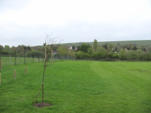
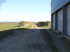
Start at ST 911 532, Bratton Recreation Ground

Bratton Recreation Ground

The Start.

In order to spread the runners out before

entering Trowbridge Road, this stage will
start by a tour of the field.


Be careful entering

Trowbridge Road.

Continue along this road

until you pass over the

railway bridge.

Turn immediately left onto Capps Lane,
this sign had fallen over, so may not be obvious.

a quiet road, and follow this.

...

The road bends slightly left.

A bit further on look for footpath markers

crossing the road including the WHT sign

(blue and white discs saying "White Horse Trail").

Cross the stile and continue straight ahead

keeping the big trees slightly to your right.

Aim for the gap in
the hedge to the left of the tall tree.

Continue straight across

aiming for a big tree

and a gate set in

the hedge.

Continue along this next field

keeping the hedge to your right

until you come to another gate.

Pass through

and continue along the next field.

I saw two lovely white horses.
Keep going until you reach

a gate.
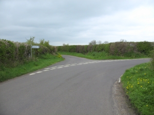
A marshal will be required at this road.

Turn right along the road (Bratton Road)

and continue along it on the left hand side

until it starts to turn right.

Turn left at this corner

and follow the footpath to the left

around the field.

(4 miles)

Turn right at the top of the field

and then

follow the track

up and

across

the next

two

fields

Here you will

meet a track.

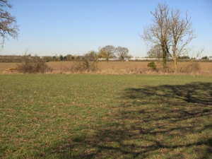
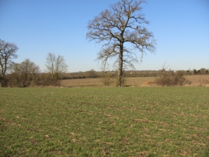
Continue straight

on up the hill to East Town Farm.

View looking back
when we were pioneering this stage.

After the farm buildings turn right
and

follow

a winding track

(here, keep to the path on the right)

which proceeds on

down hill to ...

(don't cross this stile)

...

.

... a junction of tracks.

Turn left here

along the track.

Follow

this

track.

Cross the bridge (plank)

and continue along

the track.

Follow

the

footpath

and the track across the field.

At the end of the field you will see

a sign. Turn right here

and

follow

the

lane.

Turn right here

into Butts Lane

which leads into

Steeple Ashton.

Turn left into the High Street.
A marshal will be required here. This is a good place to 'water' your runners.

Turn right into Church Street.

Just before the Church there is a pathway

on the left marked

"Wiltshire County Council, Public Footpath".
Turn left here and go past the churchyard

to the end of the wall.
Go through
the kissing gate marked with the WHT sign

and continue round the churchyard wall.

At the end of the churchyard wall go through a

gap and bear right to a new gate marked WHT.

Go through this and immediately,

on your left, is another new gate marked "Mid
Wilts Way" and "Wiltshire County Council,
Public Footpath". Go through this

and diagonally (right) across the next field

aiming for the trees in the corner to

the gate.

Continue across the next field (you are near

the right hand end of it) to another gate.

Go over the small bridge to a kissing gate and

you will see a post marked with the WHT sign.

Follow the track to the end of the next field.

At the end there is a spinney.

Do NOT turn right through the gate which is
not part of the White Horse Trail but

carry straight on.
You will see an old large gate in front of you.
Next to this is a small new gate marked WHT.

Go through this and continue along the edge of the
spinney for about 50 yards before turning right

through a kissing gate also marked WHT.

At this time of year parts of the route can be
heavily infested with sting nettles and thistles.
Also beware that there can be temporary electric fences restricting grazing cattle in fields on the route. Gardeners probably know that nettles flower from May to September! The farmer has very kindly cleared the nettles.

Go back along the other side of the spinney

...

At the end of this field pass through a gate

marked "Mid Wilts Way" and along a track.

At the end of the track you continue along the edge

of a field to a wooden kissing gate marked WHT,

then along a narrow track to another wooden

kissing gate marked WHT and into a field.

Keep the hedge on your left until you come to

a metal kissing gate marked WHT.

Go diagonally across the field

to a metal gate marked WHT.

Cross the bridge and enter

the churchyard of Keevil Church.

Go straight through

and you will come

...

to the main street.
This is Keevil.

Turn right on to Main Street and

follow it as it turns left

and then bends slowly to the right.
Keep to the right hand side of the road. Do not use the footpath as it would mean crossing the road twice.

.

.

.

After the last house on your left

the road turns sharply left again.

Follow this road
and take the turning to the left.

This is a quiet road ...


Soon you come to
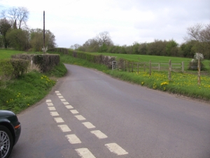
a junction. Turn left.

and

continue

to the

finish

on the grass.
Parking will be in the field to the left (you may need to open the gate) with the kind permission of the owner.
Route by car to follow this stage.


![]()
![]()